The Next Map of Fargo-Moorhead: 7 Growth Zones · Fargo INC!
Businesses
The Next Map Of Fargo-Moorhead
Seven development zones, two clocks and one big question: how much growth should move outward, and how much should be absorbed by places the community has already paid to serve?
In shortFargo-Moorhead's first land development code rewrite since 1998 maps seven distinct growth zones shaped by infrastructure readiness, with a policy target of at least one-third of future growth in already-developed areas.
3 things to know
1Fargo's adopted Growth Plan projects roughly 15,000 additional households and about 30,000 additional residents by 2045, with at least one-third of growth targeted to existing developed areas.
2The $3.2 billion flood diversion is expected to reach 'Flood Year Protection' in March 2027, but updated federal flood maps may not arrive until roughly 2029, limiting immediate development impact.
Generated by Claude · grounded in this articleNever used on sponsored content
At the western edge of the Fargo-Moorhead metro, the horizon is flat, the parcels are large, Interstate 94 is close, the $3.2 billion flood-diversion system is nearing the point when it can protect the metro, and on a map, growth appears free to move in almost any direction.
But the next map of Fargo-Moorhead will not be drawn on empty land alone.
It will be drawn by the diameter of a sewer main, the capacity of a lift station, the timing of a road connection, the distance between a job and a worker, and whether a project can proceed by right or must survive months of discretionary approvals. It will also be drawn by a question that has become unavoidable as the metro spreads: how much growth should move outward, and how much should be absorbed by places the community has already paid to serve?
That question is now embedded in Fargo’s first comprehensive Land Development Code rewrite since 1998. The city’s adopted Growth Plan projects roughly 15,000 additional households and about 30,000 additional residents by 2045. Its policy target is equally consequential with at least one-third of future growth should occur downtown, in core neighborhoods, and in other already-developed areas, while no more than two-thirds should go to greenfield development.
The result is not one growth frontier. It is seven distinct development zones, each with a different business case and a different clock.
Some are ready for reinvestment now. Some are being unlocked by infrastructure already under construction. Others are long-horizon opportunities whose value depends on public investments and regulatory milestones that have not yet arrived.
Two Clocks Are Running
The metro is growing on two clocks.
Market clock. The first is the market clock, which includes housing demand, business expansion, medical-office growth, retail gaps, hotel demand, construction costs and the availability of workers. A 2025 business-retention survey by the Greater Fargo Moorhead Economic Development Corporation found that 60% of participating primary-sector companies were considering an expansion within one or two years. Manufacturing, software and hardware, value-added agriculture, logistics and agricultural technology were among the strongest categories. Employers also identified workforce availability, suitable space, construction costs and infrastructure as recurring constraints.
Infrastructure clock. The second is the infrastructure clock. A parcel may be zoned for business and still be years away from supporting it. A road may exist but be at peak-hour capacity. A sewer extension may require an equalization basin, a lift station, and a force main before the first building can connect. Flood protection may reduce long-term risk without immediately changing a federal flood map.
Best positioned for mixed-use housing, hospitality, small and midsize offices, restaurants and retail, medical and professional services, and education-adjacent uses.
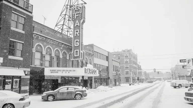
Downtown Fargo has the metro’s strongest case for growth without geographic expansion. Streets, utilities, transit, public parking, cultural assets, and a concentration of employers are already in place. The development challenge is not extending the city. It is assembling sites, adapting older buildings, and making denser projects financially workable.
The economics are different from the edge. Downtown land is rarely cheap, demolition and environmental conditions can complicate a project, and structured parking can dominate a pro forma. Yet those costs are offset by access to existing infrastructure, a walkable customer base, nearby workers, and tools such as the Renaissance Zone.
The city’s own investment is signaling the direction. The NP Avenue Garage opened in November 2025 with 480 city-owned parking spaces. The surrounding mixed-use project is scheduled to add 168 apartments, a new home for Fargo Moorhead Community Theatre, and commercial space.
The opportunity extends beyond the downtown core into older commercial corridors and neighborhoods where underused parcels can support missing-middle housing, neighborhood retail, clinics and smaller offices. Here, the decisive issue is regulatory. If the new code makes desired infill predictable by right, while setting clear standards for form, transitions and public space, the city can reduce approval risk without lowering expectations.
Downtown and the core will not capture every fast-growing company. Large-format industrial users and distribution facilities need land and truck access that the center cannot provide. But the district is the region’s clearest answer to employers competing for talent, with a place where work, housing, food, entertainment and civic life can exist within a short trip.
South Fargo And 52nd Avenue
Best positioned for medical offices, neighborhood and regional retail, hospitality, professional services, multifamily housing, and mixed-use nodes.
For more than a decade, south and southwest Fargo have carried an extraordinary share of the city’s expansion. From 2010 to 2020, the area accounted for 96% of Fargo’s new single-family homes, 76% of its multifamily units, 80% of net new retail space and 96% of net new office space, according to the Fargo Growth Plan.
The 52nd Avenue corridor is where that residential momentum is turning into a broader business district. Its conversion from a rural two-lane road into a four-lane divided arterial included storm sewer, water main, shared-use paths, lighting, and new Drain 27 bridges. The city estimated traffic at roughly 12,000 vehicles a day, rising toward 20,000.
Those investments create the skeleton for more than strip retail. The stronger long-term play is a series of mixed-use nodes at major intersections: medical and dental offices, hotels, restaurants, childcare, daily-needs retail, multifamily housing and professional services that can serve both nearby residents and commuters from Horace and the southwest metro.
The question is whether the corridor develops as a sequence of connected places or as isolated pads. The city’s new code and growth plan place greater emphasis on block structure, internal street connections, housing variety, and non-auto travel. That matters because the public cost of growth rises when each project requires a new signal, a new access point, or a longer utility extension.
South Fargo remains highly attractive, but its advantage is no longer simply inexpensive land. The most valuable sites will be those where roads and utilities are already sized, access can be shared, and a developer can deliver density without first financing a miniature public-works program.
North Fargo And The Airport-Industrial Area
Best positioned for aviation services, logistics, light manufacturing, research and technology companies, suppliers, training facilities, and select hospitality.
North Fargo has a combination no other part of the metro can replicate with Hector International Airport, Interstate 29, rail access, industrial land, and North Dakota State University’s research and workforce pipeline.
The airport’s new terminal expansion opened in February 2026, following the opening of its parking ramp in August 2025. Remodeling of the existing terminal is expected to continue through 2027. That investment strengthens the airport as a regional gateway, but its development influence extends beyond passenger travel. Aviation-related services, time-sensitive logistics, specialized manufacturing, and companies that value rapid access to customers and technical talent can all make a location case here.
The strongest opportunity is not a generic warehouse district. It is a cluster in which the airport, NDSU, existing manufacturers, and the region’s agricultural-technology base reinforce one another. Research operations, testing, component suppliers, unmanned-systems businesses, and skilled-trades training can use proximity as an advantage.
The constraints are equally specific. Airport safety and noise zones restrict some uses. Rail lines and established industrial parcels can complicate connections. Large sites may require assembly, environmental review, or infrastructure upgrades. Workforce access also matters. A job district that is convenient for trucks but difficult for employees to reach will be less competitive than it appears on a freight map.
North Fargo’s future depends on treating access as a system, including the airport, highway, transit, street connections and workforce pipelines, not as a single interchange.
West Fargo And The I-94 Corridor
West Fargo’s next major employment district may not be where a casual look at the map suggests.
The open land southwest of I-94 appears to be the obvious frontier. West Fargo’s 2026 Growth Area Plan shows why it is not yet the easiest one. Existing roads are already under pressure at peak periods. Major sewer facilities, lift stations, and equalization storage are needed. Cass County Electric has identified substantial distribution upgrades. School capacity and the timing of a new crossing also shape the pace of development.
The more immediate opportunity is north of the interstate, around the 12th Avenue corridor and the city’s former lagoon properties. West Fargo’s plan identifies roughly 600 acres for a mixed business and industrial campus that could accommodate data centers, distribution, light manufacturing, a corporate campus, and supporting commercial uses at key intersections.
West Fargo is advancing a modified force main with Mapleton that can serve at least 2,500 acres west and southwest of the city, along with a high-capacity lift-station project south of I-94. Those projects improve the long-term outlook, but they do not make every western parcel equally ready on the same day.
For businesses, the I-94 corridor offers freight access, visibility, and scale. For developers, the winning sites will be those with documented utility capacity and a credible schedule, not simply a future land-use designation. The district’s ultimate strength could be a mix of employment and services rather than a single-use industrial park, but that outcome will depend on reserving land for jobs before residential pressure consumes the most accessible sites.
Horace And The Southwest Metro
Best positioned for neighborhood retail, childcare, clinics, professional services, restaurants, construction trades, small-scale light industrial, and community-oriented mixed use.
Horace’s growth story begins with rooftops. The city’s population has increased more than fivefold since 1990, and new subdivisions have pushed the urban edge toward West Fargo and south Fargo. The next business opportunity is to turn that population growth into a more complete community.
The 64th Avenue corridor is central to that shift. As subdivisions and a school site emerged along what had been a rural road, the corridor gained a larger water trunk, urban street improvements, sewer and stormwater infrastructure, shared-use paths, and a connection toward County Road 17. Those investments can support the daily services that rapidly growing neighborhoods need.
Horace is therefore positioned first for businesses that follow households with grocery and convenience retail, restaurants, childcare, dental and medical clinics, fitness, financial services, and professional offices. Its construction base and highway connections also create room for trades, service-commercial uses and smaller industrial operations.
The downtown neighborhood plan adds a second opportunity. A stronger central business district could give Horace something subdivisions alone cannot create: a recognizable civic and commercial center. That will require deliberate land assembly, street design, and a mix of housing and storefront uses scaled to the city’s market.
Horace should not be read as the metro’s next large office-tower district. Its near-term advantage is local demand and room to build. Its challenge is that apparently lower land prices can be narrowed by utility extensions, special assessments, and road obligations. The relevant number is not the asking price per acre. It is the fully served cost per buildable foot.
Downtown And East Moorhead
Best positioned for downtown mixed use, housing, hospitality, arts, and civic uses; in east and southeast Moorhead, rail-served industry, manufacturing, logistics, and value-added agriculture.
Moorhead’s development map has two engines.
The first is downtown, where major public projects and private housing are remaking the center at the same time. Fairmont Flats has added 105 units. The five-story 650 Center project is planned to combine businesses with 153 housing units. The Loop, Moorhead’s new library and community center, adds free coworking, entrepreneurship services and a civic anchor. The $171.6 million 11th Street railroad underpass project, expected to reach completion in fall 2026, is designed to improve safety and reconnect the street network across the rail corridor.
Moorhead’s Renaissance Zone, tax-increment financing district, and the state’s extension of the downtown TIF construction window all improve the financial case for reinvestment. The opportunity is a denser center with more residents, restaurants, small offices, hospitality and cultural uses. The constraint is that every large downtown project must solve parking, construction cost, and site-assembly questions while the district remains in transition.
The second engine is east and southeast Moorhead, especially the MCCARA industrial area. The city markets a 197-acre shovel-ready site with direct access to the I-94/34th Street interchange, heavy-duty concrete streets, large sanitary and storm utilities, retention capacity, and rail service through Otter Tail Valley Railroad and BNSF connections. A $2 million state infrastructure grant is supporting the area’s expansion.
That gives Moorhead one of the metro’s clearest large-site industrial propositions. Manufacturers, rail users, distribution companies and value-added agricultural businesses can evaluate a site with infrastructure and transportation already defined. Minnesota’s incentive structure can also be part of the comparison, although the winning offer will depend on the specific project, wages, and capital investment.
Taken together, downtown and MCCARA give Moorhead a balanced strategy of urban reinvestment at the center and job-intensive land at the edge.
Diversion-Adjacent Land: The Risk-Reduction Frontier
Best positioned for long-horizon employment nodes, selected mixed-use growth where utilities and roads can be extended, and recreation-oriented development near, but outside, project operations and easements.
No infrastructure project will change the metro’s long-term development psychology more than the Fargo-Moorhead Area Diversion. But the line between flood protection and development readiness must remain bright.
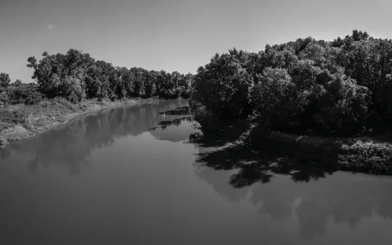
Along the river that runs through the metro
The Metro Flood Diversion Authority expects the project to reach “Flood Year Protection” in March 2027. That milestone should dramatically reduce regional flood risk. It will not, by itself, redraw the official federal flood-insurance map. The authority says the FEMA Letter of Map Revision process could take as long as two additional years, meaning updated maps may not arrive before roughly 2029.
Nor does the channel create roads, sewer, water, power, or zoning. Some adjacent land is constrained by operations, environmental requirements, flowage rights, maintenance access, or public ownership. Other parcels may be well positioned but still sit beyond the economic reach of municipal systems.
The right way to read diversion-adjacent land is as a long-term risk-reduction frontier, not a blanket development zone. Places where the project aligns with planned roads, utility extensions and adopted growth areas will gain the strongest development case. Elsewhere, greenways, habitat, trails and agriculture may remain the better uses.
That nuance will matter as land speculation increases. Buyers should verify parcel-specific flood status, easements, post-project mapping, service plans and annexation assumptions before assigning urban value to land near the channel.
Editor of Fargo INC! — covering the founders, companies, and ideas shaping business in Fargo-Moorhead. Eleven years in, still no opinions, no politics, all business.