The Ag Spy: How Lanny Faleide Mapped the Future of Farming From Space · Fargo INC!
People
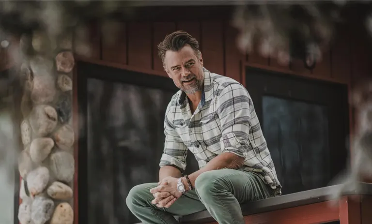
The Ag Spy: How Lanny Faleide Mapped the Future of Farming From Space
In central North Dakota, where the horizon rolls out like a blanket of possibility, Lanny Faleide was never just watching the skies—he was reading them.
In shortIn central North Dakota, where the horizon rolls out like a blanket of possibility, Lanny Faleide was never just watching the skies—he was reading them.
3 things to know
1In central North Dakota, where the horizon rolls out like a blanket of possibility, Lanny Faleide was never just watching the skies—he was reading them.
2Long before “ag tech” became a buzzword or satellite imagery became a staple in precision agriculture, Faleide was already fusing his love of flying with his intuition for the land, unknowingly laying the groundwork for a technology revolution.
3His path wasn’t scripted in Silicon Valley boardrooms or venture-backed accelerator halls.
Auto-summary · grounded in this articleNever used on sponsored content
In central North Dakota, where the horizon rolls out like a blanket of possibility, Lanny Faleide was never just watching the skies—he was reading them. Long before “ag tech” became a buzzword or satellite imagery became a staple in precision agriculture, Faleide was already fusing his love of flying with his intuition for the land, unknowingly laying the groundwork for a technology revolution. His path wasn’t scripted in Silicon Valley boardrooms or venture-backed accelerator halls. It began in a tractor, in a cockpit, and eventually, in the quiet conviction that there had to be a better way to understand the soil beneath our feet.
In the 1980s, farming was unraveling. Interest rates climbed to 21%, land values plummeted, and the American Midwest felt like a region in retreat. Faleide, a farmer and licensed pilot, had already logged countless hours in the air—surveying his own fields and noting patterns in the way crops grew, struggled, or failed.
“Even in the ’70s and ’80s,” he said, “I was taking pictures of my fields and noticing differences. That’s when I realized the potential of satellite imagery.” But seeing potential and realizing it are two very different things.
He and his wife made the difficult decision to leave the farm, return to school, and rebuild their lives from scratch. It was a painful but calculated risk—a pivot not away from agriculture, but toward its future.
That choice was the first of many that would define his next three decades. He went on to found a company focused on extracting and interpreting satellite-derived biomass signatures—imagery that could reveal with striking precision which parts of a field were productive and which were failing. His early clients weren’t venture firms or multinational agribusinesses, but regional players like American Crystal Sugar.
“That first contract was for $92,000,” he said. “And it changed everything.”
The Birth Of An Ag Spy
Lanny Faleide refers to himself as an “ag spy,” a term that, at first sounds whimsical—maybe even self-deprecating. But that nickname reflects a career spent peering into the secrets of the earth, using satellite eyes to track, analyze, and decode the silent messages of farmland across continents.
That first job with American Crystal Sugar blossomed into nearly two decades of consulting work, covering over 500,000 acres of sugar beets across the U.S. and Canada. During that time, Faleide refined a datadriven system capable of rendering an intimate portrait of crop health at scale, helping growers make better decisions while preserving resources.
Along the way, he resisted the path many ag-tech companies followed—building sprawling teams of agronomists, launching consulting arms, and expanding for expansion’s sake. Instead, he envisioned a lean, SaaS-based model where farmers or their advisors could subscribe to his platform, map their fields, and extract insights on their own. This DIY approach kept overhead low, empowered users, and established a scalable model well before “agile” and “cloud-native” became industry norms.
Even in the early days of broadband, he was distributing tools via physical media—CDs and DVDs—which gave way to cloud services as early as 2000. By the time SaaS became a corporate buzzword in the mid2000s, Lanny’s system was already mature. And NASA took notice— not once, but twice. The agency recognized Faleide’s company in both 2000 and 2016 for its pioneering use of geospatial data in agriculture. At the time, many in the industry still struggled to pronounce “NDVI” (Normalized Difference Vegetation Index), let alone leverage it to inform field management decisions.
Faleide’s company Satshot was recognized by NASA in both 2000 and 2016 for its pioneering use of geospatial data in agriculture.
“I didn’t even realize the extent of what we were doing at the time,” Faleide said. “It felt like a foreign language. But that’s a little bit of my claim to fame.”
n the tech world, the prevailing narrative often champions scale— raise capital, grow fast, dominate markets, exit big. But Lanny Faleide never subscribed to that doctrine.
Satellite dishes encased in white domes sit on the edge of Lanny's property, locking onto passing satellites for ten-minute bursts, capturing imagery of the United States and beyond.
From the start, he took a different path. His company didn’t explode; it evolved. It wasn’t defined by headcount or headlines, but by the quiet consistency of real innovation and real value delivered over time.
Early on, Faleide understood that the strength of his company would lie in the power of its technology and the simplicity of its delivery.
By 2000, long before the cloud dominated enterprise computing, they had already implemented the bones of a SaaS model. What others were still imagining, they were deploying. And when Amazon Web Services launched in 2006, the industry scrambled to catch up to what Lanny’s team had already proven possible.
“I used to have 12 to 15 employees,” he said, “but today, I don’t hire anyone. I work with contractors. We built such a good core that I don’t need a big team. I’m the CEO of myself. I don’t want to work extremely hard anymore—and I don’t have to.”
He balances work with family, avoids meetings he doesn’t need, and maintains full ownership of his company. No shareholders to appease. No quarterly earnings calls. Just freedom.It’s not that he didn’t have opportunities to cash out. In fact, at one point, he was one vote shy of joining an elite satellite investment group—a move that, by his own estimation, might have made him one of the wealthiest people in the region. “It didn’t materialize,” he said. “And honestly, I don’t regret it. I might not even be alive today. I could’ve been thrown over the railing of my own yacht.”
And yet, the work continues. From his home in North Dakota, Lanny runs a global business on a laptop. His systems live on the Google Cloud, and he can resolve a technical issue during a Bison game with a single text to a programmer. “It cost me $20,” he said, “not $100,000 a year to have someone on-call.”
His software holds more than approximately 800 terabytes (and growing) of geospatial data—comprising decades of spectral analysis, imagery, and field signatures.
“That system is like farmland,” he said. “You invest in it, cultivate it, and eventually, it becomes incredibly valuable.”
The Farmertinkerer Behind A Quiet Data Empire
Lanny Faleide may operate one of the most advanced geospatial data systems in North America, but his roots and his rhythm are still rural.
From his farmstead—now essentially a makeshift space center—Lanny oversees a quiet technological powerhouse. Satellite dishes encased in white domes sit on the edge of his property, locking onto passing satellites for ten-minute bursts, capturing imagery of the United States and beyond.
“A lot of the satellite images you see on TV—North Korea, Gaza, Russia— they’re coming through my farm,” he said.
Lorem ipsum dolor sit amet, consectetur adipiscing elit. Ut elit tellus, luctus nec ullamcorper mattis, pulvinar dapibus leo.
Failure wasn't an option. That's something I learned on the farm." - Lanny Faleide
His farm is still his sanctuary, even if it now doubles as a data relay hub for satellites orbiting hundreds of miles above.
At one point, during a stretch from 2010 to 2019, Lanny and his company explored launching their own satellite.
“We talked about it, but that path is for a whole different league of people—it takes millions of dollars and a very calculated, almost diabolical approach,” he said.
That doesn’t mean Faleide hasn’t poured a lot of capital into his system. In fact, he estimates that he has poured nearly $10 million into it over the course of his career.
But, even with that big project, he has maintained his independence. He can spend time with his wife. He has helped his son take on more of the business. He plays guitar at bluegrass jams. He drives 200 miles between Fargo and his farmstead while brainstorming new ideas or catching up on calls. “That’s where I do some of my best thinking,” he said. “I enjoy the peace and quiet.”
While agriculture remains his company’s bread and butter, mining companies now tap his technology for environmental monitoring. “We’re working with a major gold mining operation in Nevada,” he said. “They have to monitor vegetation, erosion, and runoff, and we provide them with satellite data to do that. It’s the same core technology—just applied differently.”
Lanny’s commissioned work of the North Dakota landscape from space, hanging in New York’s Guggenheim Museum in 2020 for “The Countryside Exhibition."
This crossover power has enabled Lanny’s company to explore entirely new markets without having to build separate infrastructures for each. “Whether we’re selling to farmers, consultants, or ag companies, the technology just connects,” he said. From your iPad to a John Deere tractor, or from a satellite to a mine site—it just works.”
The system’s reach doesn’t end with farming and mining. It has implications for wildfire tracking, infrastructure monitoring, and even national security. “We’ve looked at wildfire zones using near-infrared data,” Lanny said. “We can pinpoint areas with dense vegetation—prime spots for fires to start or spread.” And then there’s the customer experience. Faleide still talks to users personally. Like the farmer from Nebraska who called him on a whim, frustrated with expensive consulting fees.
“He wanted to do things himself but didn’t know how,” Lanny said. “I told him, ‘You can do this. You just need a little help.’”
In a world increasingly driven by data, Lanny’s platform, with nearly 30 years of data already cataloged, offers a level of insight few systems can match.
Still, he’s cautious. “We’ve had all kinds of offers over the years,” he said. “Partnerships, expansions, investments. But I’ve learned to be careful. Not all growth is good.”
The New Frontier
Lanny Faleide is a man of fields, clouds, and code—but he’s also a philosopher of consequence. Behind every satellite image and line of custom software lies a deeply rooted awareness: technology, no matter how elegant or efficient, has ripple effects far beyond its intended use. And in a world increasingly shaped by automation, algorithms, and artificial intelligence, Faleide’s voice is a necessary counterweight—a reminder that innovation must walk hand in hand with ethics.
“AI is just scripts and bots, really,” he said. “We’ve used things like that for years—we just didn’t call it AI.”
It’s a theme that crops up often in conversation with Faleide. He has seen how data, once captured, doesn’t disappear. “I’ve got approximately 800 terabytes (and growing) of imagery in my system. It’s always there. Spinning on servers. Consuming energy. Staying accessible. Social media works the same way. My kids, my grandkids— they’re growing up in a world where nothing is ever forgotten. You post something dumb at 20, and it can follow you for the rest of your life.”
When he mentors younger entrepreneurs or advises his family, he’s quick to caution that just because you can do something doesn’t mean you should.
He extends that lens to the agricultural sector, where rapid automation and consolidation are reshaping rural America.
“Farms are getting bigger. Technology is making them more efficient. But what’s happening to the small towns?” he asked. “The schools close. The churches empty. The communities disappear.”
And yet, he believes in AI’s promise. Not as a replacement for human intelligence, but as an augmentation. He talks about manually analyzing satellite images in the early days— hours of work for a single field. “Now, I can run thousands of fields in one batch. The system does the work. I just check the results.”
When asked if he’d do it all over again, Faleide doesn’t rush to answer. “Honestly, I don’t know,” he said. “It’s been an incredible ride, but it’s also been tremendously challenging.”
Editor of Fargo INC! — covering the founders, companies, and ideas shaping business in Fargo-Moorhead. Eleven years in, still no opinions, no politics, all business.